


Refugio Rambla Seca - Refugio Campo del Espino

This stage of the Bosques del Sur trail runs through the Los Campos de Hernán Perea plateau, which is one of the grandest and most authentic landscapes in the natural park. It is a terrain with very few slopes, but full of sinkholes and chasms, very representative of the karst landscape, and flanked by the great heights of the park, such as Empanadas, Puerto Lézar and El Banderillas. With its more than five thousand hectares, Los Campos has sometimes been characterized as a lunar landscape, where the craters would be the sinkholes, with their inverted funnel shape.
It is a cattle route, since during part of the route it runs along cattle trails. This is the home of most of the natural park's cattle hut, whose main protagonist is the Segureña sheep, a breed highly adapted to these mountains. Precisely the particularity of the area that we travel is that it is the only area of ??the natural park where the main economic resource of its inhabitants is not the olive grove, but sheep farming.
Depending on the season of the year in which we do this tour, we will get a different impressio ...
This stage of the Bosques del Sur trail runs through the Los Campos de Hernán Perea plateau, which is one of the grandest and most authentic landscapes in the natural park. It is a terrain with very few slopes, but full of sinkholes and chasms, very representative of the karst landscape, and flanked by the great heights of the park, such as Empanadas, Puerto Lézar and El Banderillas. With its more than five thousand hectares, Los Campos has sometimes been characterized as a lunar landscape, where the craters would be the sinkholes, with their inverted funnel shape.
It is a cattle route, since during part of the route it runs along cattle trails. This is the home of most of the natural park's cattle hut, whose main protagonist is the Segureña sheep, a breed highly adapted to these mountains. Precisely the particularity of the area that we travel is that it is the only area of ??the natural park where the main economic resource of its inhabitants is not the olive grove, but sheep farming.
Depending on the season of the year in which we do this tour, we will get a different impression. In winter it is an area of ??heavy snowfall and in spring there is plenty of water and green pastures. In summer and autumn the landscape is harsher, drier, but it is probably when there is more life, with the thousands of head of cattle that graze here. In any season of the year, this is an essential stage for those who know the natural park in a comprehensive way.
At the end of this stage we find two alternatives. One kilometer before the end, diversion 5 begins, towards the summit of El Banderillas. Next to the Campos del Espino refuge, the GR 247.2 variant begins in a vertiginous and exciting descent to the Guadalquivir valley.
Technical information
Route Name Rutas Bosques GR247
Rutas Bosques GR247 16: Refugio Rambla Seca - Refugio Campo del EspinoHUSO 30S
Refugio Rambla Seca: x518877 y4200118
Refugio Campo del Espino: x524433 y4209653
Refugio Rambla Seca: x518766 y4199910
Refugio Campo del Espino: x524321 y4209445
TOTAL DISTANCE (IN KILOMETERS)13650
Asphalt or cement section 0 %
Section of track or forest road or promenade 0 %
Senda section 0 %
tramos-de-Vía-pecuaria 100 % - Vía verde 13650 m
ESTIMATED RUN TIMEO
3 h 6 minMAXIMUM SLOPE199 m
DIFFICULTY. ASSESSMENT ACCORDING TO METHOD MEASURE
2
MEDIO.
Severity of the natural environment
2
Itinerary
Orientation in the itinerary
1
Displacement
Difficulty moving
3
EFFORT.
Amount of effort required
TOTAL DISTANCE (IN KILOMETERS) 19540 M
Start
The Rambla Seca Refuge is accessed from the village of Don Domingo, on the J-9005 road that arrives from the vicinity of Santiago de la Espada. From Don Domingo, continue along the Campos de Hernán Perea forest track.
Final
By forest track from the village of Don Domingo and from the Nacimiento del Segura.
INTERMEDIATE POINTS
PLACE
POSITION
TYPE OF ROAD
Km 2,8
Forest track
Km 10,6
Km 10,6
CYCLABILITY
No difficulties
WATER POINTS
Surrounding the Rambla Seca Refuge, La Cañada del Rincón Refuge (cistern), well 1.3 kilometers from the previous point, Campo del Espino Refuge (cistern).
PREFRESHING POINTS
On the trail: There is no
Near the trail: No
LINKS WITH OTHER TRAILS
GR 144
Rutómetro
Rambla Seca Shelter
The stage starts from the Rambla Seca Refuge along a forest track over a cattle track heading northeast. After 150 meters, we leave the Rambla Seca fountain and watering hole on the right and gradually enter this plateau. To the right we have the Puerto de Lézar and the Empanadas (2107 meters).
In the first part of the route, this section of the Bosques del Sur trail coincides with another long-distance trail, the Sendero de la Trashumancia GR 144, of approximately 80 kilometers, which goes from Rambla Seca to Puente Mocho in Beas de Segura, always by livestock routes. In this initial area, although it may not seem like it, there are fertile lands that mean that some cereals are still grown to feed livestock, so it is common to find a plot plowed or sown with varieties adapted to these conditions.
Fork
We come across a fork in the forest tracks and at this point we leave the GR 144 on the right, which would take us to the village of Don Domingo. We continue on the left track, which soon begins to meander, to save the many sinkholes of the terrain. A sinkhole is a typical depression of the karst reliefs, formed by the dissolution of limestone rocks. In these sinkholes, when water is abundant and its reception capacity is saturated towards the interior of the rocky massif, lagoons can form that in winter become frozen. Other karst formations in this area are chasms and caves, sometimes associated with the center of the sinkholes. We always walk above 1600 meters, having on our left a mountain ridge around 1750 meters of altitude. The area is rockier than the initial section. Almost two kilometers from the detour, we pass a herd or herd of cattle to the left and the track continues on a slight ascent.
The tall
Continuing along the track we reach this point which, with an altitude of 1748 meters, an important point from which we can contemplate almost the entire route we have made and several of the kilometers that we will travel later. If it weren't for the fact that on the flanks of Los Campos we always have several higher altitude mountain sentries, it would be very difficult to find our bearings, since the landscape in which we are immersed is very homogeneous and has few references that stand out clearly. Without realizing it, from Rambla Seca, we have ascended 150 m in altitude in a predominantly flat-looking landscape. From this moment there is a slight descent to go back up later.
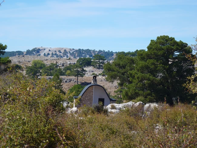
Cañada del Rincón refuge
To our left is this refuge, similar to the rest of those found in the Los Campos area, which were built by the Institute for the Conservation of Nature (ICONA) in the 70s of the last century, traditionally used by shepherds and recently restored. Behind him is the Calar del Pino, a predominantly rocky mountain that rises above the plateau. Shallow wells are very common to collect water for cattle in the summer months. We will find one of them 1.3 kilometers from the refuge, at the foot of the track, on the right. Formerly, wooden logs were used, which were emptied to make the troughs (tornajos), although in recent times many of them have been replaced by metal basins, which represents a regrettable loss in terms of aesthetics.
Crossing tracks
Right in front of Calar de Camarillas we come to a crossroads where we must turn left; the track on the right would take us to the village of Don Domingo through the Barranco del Borbotón.
Our path continues to climb, until we reach a hill about 400 meters from the aforementioned crossing. At this point a less traveled track appears to the left that we must ignore. In addition, it is essential to move away momentarily just 100 meters to the left of our route to go down to the deepest part of the large bowl –dolina– on which we are. We will be able to contemplate the Sima del Hundimiento, which is an almost perfect funnel of about 16 m deep, with a first vertical section and two descending galleries parallel to each other.
Campo del Espino Natural Viewpoint
At 500 meters from the previous hill, having left a plantation of black pines on the left, and before starting to descend from the 1776 meters of altitude that we have reached, we find on the left a conical hill to whose top tracks of 4x4 vehicles. It is worth going up to it because it is an exceptional viewpoint of Campo del Espino, Pinar Negro, Cordillera del Banderillas and Calar de las Palomas, among other places. In the distance we can already see the Campo del Espino refuge, beyond the lonely poplar that constitutes the only vestige of the groves that existed in this area in times past.
Crossing tracks in Campo del Espino
To the right, and closed to traffic with a barrier, there is a track with GR 247 signs. It is one of the most attractive diversions (d-5) of the Bosques del Sur trail, the one that ascends to the Cumbre de El Banderillas, which is also described in this guide and from which you can enjoy one of the best mountain views in Andalusia.
Campo del Espino Refuge
The stage ends in this shepherd's refuge, which has a cistern to collect rainwater, with a manual pump for its extraction. Remember that it is water without any sanitary treatment. From the refuge we have several options. On the one hand, the aforementioned derivation to the Cumbre del Banderillas; on the other, one of the stages that make up variant 247.2 of this Bosques de Sur trail that would take us to the town of Coto Ríos; and, finally, stage 17 of the main route that will take us to Pontones.
Additional information
Transhumance is still alive
This stage runs through a purely cattle-raising area where the ancient practice of transhumance is still alive, which some cattlemen from Santiago-Pontones –especially from the village of La Matea– continue to carry out. Every winter, when the pastures in the high areas of the natural park are not usable, they undertake the long way down to the grazing areas of the Sierra Morena Jaén and La Mancha, where the sheep spend several months feeding on the pastures caused by the mild climate lowland winter. When spring is over and the grasslands in those areas are exhausted, they will make their way back to their native pastures in the Sierra de Segura, where the pastures begin to be large and juicy and where they will feed during the spring and summer.
Taking advantage of natural herbages in this way by taking livestock to the right place at the right time is a very ecological way to take advantage of resources, because it saves artificial feed and, therefore, the water and energy necessary to manufacture and ...
Transhumance is still alive
This stage runs through a purely cattle-raising area where the ancient practice of transhumance is still alive, which some cattlemen from Santiago-Pontones –especially from the village of La Matea– continue to carry out. Every winter, when the pastures in the high areas of the natural park are not usable, they undertake the long way down to the grazing areas of the Sierra Morena Jaén and La Mancha, where the sheep spend several months feeding on the pastures caused by the mild climate lowland winter. When spring is over and the grasslands in those areas are exhausted, they will make their way back to their native pastures in the Sierra de Segura, where the pastures begin to be large and juicy and where they will feed during the spring and summer.
Taking advantage of natural herbages in this way by taking livestock to the right place at the right time is a very ecological way to take advantage of resources, because it saves artificial feed and, therefore, the water and energy necessary to manufacture and transport them. In addition, the pastures rest for a few months, avoiding their overexploitation. But transhumance is hard for the shepherds, subject to all the discomforts and inclemencies of the trip, which lasts between one week and ten days during which they travel 150 to 300 kilometers. Today, some shepherds in the park have been able to add an ecotourism perspective to transhumance, so that this ancestral journey is in a certain way a true adventure, which is lived as a personal experience of union with nature by the people who accompany them.
The livestock routes, which are the paths through which the herds move, total 741 kilometers in the park and occupy an area of ??2,242 hectares, constituting a public heritage of great ecological, social and cultural relevance. In them you cannot build and you cannot prevent free passage.

Follow us #JaénParaísoInterior


