


Aula de Naturaleza El Hornico - Refugio Casa Forestal Fuente Acero

This long stage runs for the most part through the Sierra del Pozo and its axis is the Guadalentín River, joining the places of El Hornico and Fuente Acero, between which there is a drop of just over 500 meters, which gives us the opportunity to Get to know very diverse landscapes, from the temperate forest areas near the beginning of the route to the purely mountainous environments at its end.
We will be able to walk, if we make a short detour, next to the Guazalamanco Waterfalls, and then we will walk the famous Fishermen's Path that goes up the Guadalentín river. In the Cerrada de la Herradura we will see how this river fits deeply between high rocky walls, and then we will pass by old farmhouses already in ruins, such as the Cortijo de los Tontos or the forest house of the Ana María point, where we see testimonies of the traditional life of these mountains, while enjoying extraordinary views that extend to the peaks of Sierra Nevada.
Later we will see from above the Barranco del Guadalentín, to which we will descend through the historic cattle route of the Cañada del Mesto and ...
This long stage runs for the most part through the Sierra del Pozo and its axis is the Guadalentín River, joining the places of El Hornico and Fuente Acero, between which there is a drop of just over 500 meters, which gives us the opportunity to Get to know very diverse landscapes, from the temperate forest areas near the beginning of the route to the purely mountainous environments at its end.
We will be able to walk, if we make a short detour, next to the Guazalamanco Waterfalls, and then we will walk the famous Fishermen's Path that goes up the Guadalentín river. In the Cerrada de la Herradura we will see how this river fits deeply between high rocky walls, and then we will pass by old farmhouses already in ruins, such as the Cortijo de los Tontos or the forest house of the Ana María point, where we see testimonies of the traditional life of these mountains, while enjoying extraordinary views that extend to the peaks of Sierra Nevada.
Later we will see from above the Barranco del Guadalentín, to which we will descend through the historic cattle route of the Cañada del Mesto and then walk along the same river, in the longest section of the GR 247 that runs along a riverbed. After resting in the relaxing place of Vado de las Carretas we will reach the old Forest House of the Barranco del Guadalentín, in a spectacular setting dominated by the steep Poyos de la Carilarga.
Along the route we will pass through Aleppo pine forests, through one of the best cornicabrales in the park, through beautiful oak groves and through an exceptional oak grove of centenary gall oaks, in addition to seeing in different points bojedas, large and old black pines and vegetation of riverbank very well preserved. Vultures, raptors and the typical large ungulates of the park (deer, fallow deer, mountain goats, etc.) are very frequent to see along the entire route.
The end of this stage connects with the GR 247.3 variant. If you opt for it, you can, in two days, link directly with stages 10 and 11.
Technical information
Route Name Rutas Bosques GR247
Rutas Bosques GR247 14: Aula de Naturaleza El Hornico - Refugio Casa Forestal Fuente AceroHUSO 30S
Aula de naturaleza El Hornico: x506978 y4180989
Refugio C.F. Fuente Acero: x513170 y4194859
Aula de naturaleza El Hornico: x506867 y4180782
Refugio C.F. Fuente Acero: x513059 y4194651
TOTAL DISTANCE (IN KILOMETERS)21410
Asphalt or cement section 0 %
Section of track or forest road or promenade 65,44 %
Senda section 34,56 %
tramos-de-Vía-pecuaria 0 %
ESTIMATED RUN TIMEO
5 h 24 minMAXIMUM SLOPE518 m
DIFFICULTY. ASSESSMENT ACCORDING TO METHOD MEASURE
2
MEDIO.
Severity of the natural environment
2
Itinerary
Orientation in the itinerary
2
Displacement
Difficulty moving
3
EFFORT.
Amount of effort required
TOTAL DISTANCE (IN KILOMETERS) 19540 M
Start
El Hornico is accessed from Pozo Alcón on the A-315 road.
Final
The Fuente Acero Forest House Refuge is accessed from the Empalme del Valle, on the A-319 road. From there, take the JF-7091 road and the track that continues to Nava de San Pedro.
CYCLABILITY
It has no special difficulties.
WATER POINTS
El Hornico, Manantial de las Siete Fuentes near Vado de Las Carretas (off the trail), spring at kilometer 15.4, Fuente Acero Forest House Refuge.
PREFRESHING POINTS
On the trail: There is no
Near the trail: No
LINKS WITH OTHER TRAILS
PR-A 317
Rutómetro
El Hornico Nature Classroom
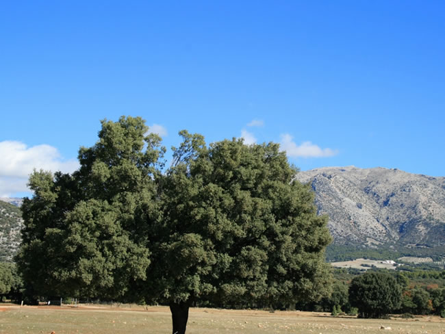
The stage begins on the track that gives access to this environmental education center. To visit the center and its essential botanical garden of native plants, you have to deviate 150 meters to the left. The classroom is located next to the Arroyo del Vidrio, in an area with dense Mediterranean vegetation dominated by Aleppo pine, with a large amount of holm oak, juniper, rosemary and some junipers. We start walking along a wide forest track, which crosses the Dehesa del Rincón, on flat terrain and enjoying the company of excellent holm oaks.
At kilometer 2.5 we pass the El Hornico Training Center on the right, and at 4.3 we find on the left the signposted start of the trail to the Guazalamanco Waterfalls. Although our stage is long, the detour of just under a kilometer is very relaxing, since we will enjoy a succession of waterfalls and pools formed by the Guazalamanco stream, whose clean waters come from the slopes of Cabañas peak. Fossils abound and there are also vultures.
Continuing along o ...
El Hornico Nature Classroom
The stage begins on the track that gives access to this environmental education center. To visit the center and its essential botanical garden of native plants, you have to deviate 150 meters to the left. The classroom is located next to the Arroyo del Vidrio, in an area with dense Mediterranean vegetation dominated by Aleppo pine, with a large amount of holm oak, juniper, rosemary and some junipers. We start walking along a wide forest track, which crosses the Dehesa del Rincón, on flat terrain and enjoying the company of excellent holm oaks.
At kilometer 2.5 we pass the El Hornico Training Center on the right, and at 4.3 we find on the left the signposted start of the trail to the Guazalamanco Waterfalls. Although our stage is long, the detour of just under a kilometer is very relaxing, since we will enjoy a succession of waterfalls and pools formed by the Guazalamanco stream, whose clean waters come from the slopes of Cabañas peak. Fossils abound and there are also vultures.
Continuing along our route, the path immediately turns to the left and we observe a change of landscape, as we enter the ravine carved precisely by the Guazalamanco, already in its final section before flowing into the Guadalentín. It is an abrupt and wild place, with cornicabras, junipers and holm oaks clinging to the rocks. We cross a bridge and, shortly before the end of the track that we are traveling, we cross an exceptional cornicabral (Pistacia terebinthus), which turns red in autumn.
Fisherman's Path
The track ends and begins, between beautiful cornicabras, the Senda de los Pescadores, with the Casa del Molinillo on the left and above the Picón of the same name. We begin the path in a gentle descent, seeing to the right the narrow Guadalentín River Valley, which at this point already forms one of the tails of the La Bolera reservoir. From now on we will follow the course of the Guadalentín in the opposite direction to that of its waters through the Cañada del Mesto, a historic route by which the cattle from Pozo Alcón and Castril transhumated in the direction of the wintering areas in Sierra Morena.
Closed of La Herradura
At this point we pass over a bridge over the Guadalentín, which forms the impressive Cerrada de La Herradura, a great curve in which it is embedded deeply between vertical walls, about to be dammed at La Bolera. We leave –for a short time– the vicinity of the river and ascend, widening the valley and seeing some abandoned terraces as well as a lot of holm oak and cornicabra. Soon the vegetal landscape changes, which happens to be dominated by the reforestation pine forest. The Guadalentín reappears to our left, opening the landscape more and more towards that side, with large forests of black pine and later with holm oaks. On the right we see strong rocky cliffs of yellow and reddish tones. At kilometer 7 we take a track to the left, in the middle of a young pine forest. About 350 meters later, it turns right and we leave it to continue along a somewhat diffuse path, although marked, and immediately we see the ruins of a farmhouse on the left. We cross the cleared land of the farmhouse, with good holm oaks, following ...
Closed of La Herradura
At this point we pass over a bridge over the Guadalentín, which forms the impressive Cerrada de La Herradura, a great curve in which it is embedded deeply between vertical walls, about to be dammed at La Bolera. We leave –for a short time– the vicinity of the river and ascend, widening the valley and seeing some abandoned terraces as well as a lot of holm oak and cornicabra. Soon the vegetal landscape changes, which happens to be dominated by the reforestation pine forest. The Guadalentín reappears to our left, opening the landscape more and more towards that side, with large forests of black pine and later with holm oaks. On the right we see strong rocky cliffs of yellow and reddish tones. At kilometer 7 we take a track to the left, in the middle of a young pine forest. About 350 meters later, it turns right and we leave it to continue along a somewhat diffuse path, although marked, and immediately we see the ruins of a farmhouse on the left. We cross the cleared land of the farmhouse, with good holm oaks, following the two beacons that we will find, and then we will see in front, a little to the right, a post with directional signs. Before, you must not stop looking at the Guadalentín valley from the small meadows to the left.
At the aforementioned post (kilometer 8) we come out again to the forest track and turn left, in a pine forest that has been repopulated with black pine. Shortly after, we walked through a thick holm oak grove dotted with old and large specimens of black pine.
At kilometer 8.8 we arrive at the cleared land of two farmhouses, located at the top right and top at the front respectively. Going up to the latter, in the Puntal de Ana María, we appreciate that it is a very special place because of its surroundings - the era, the pastures, the large oaks - and because of the spectacular views: steep banks to the right, the deep valley del Guadalentín to the left –which we can look at from the era–, and backwards, that is, towards the south, great panoramic views that reach the peaks of Sierra Nevada.
Raso del Peral
We leave the farmhouse of the same name on the right and the path begins to descend gently, in a beautiful canyon with wide pastures. Shortly after, we walked among beautiful holm oaks looking at the slopes on the other side of the Guadalentín Valley, presided over by the Calar de Juana, while in the background we saw the Barranco del Guadalentín under a platform of very vertical walls that fall over the Cerrada de la Canaliega. The views are again impressive.
We go into an excellent holm oak grove and at kilometer 10.2 we pass by the ruins of a farmhouse on the right. Along the road we see a large black pine with a cavity made at its base almost two meters high. This was done in the past to remove the resinous wood chips, which were used to illuminate or light the fire. This use could be done without drying the pines, as we can see here. The oaks through which we pass are fresh, as denoted by the presence of abundant moss, ivy and hellebore (Helleborus foetidus).
At kilometer 11.5 we passed by the large plat ...
Raso del Peral
We leave the farmhouse of the same name on the right and the path begins to descend gently, in a beautiful canyon with wide pastures. Shortly after, we walked among beautiful holm oaks looking at the slopes on the other side of the Guadalentín Valley, presided over by the Calar de Juana, while in the background we saw the Barranco del Guadalentín under a platform of very vertical walls that fall over the Cerrada de la Canaliega. The views are again impressive.
We go into an excellent holm oak grove and at kilometer 10.2 we pass by the ruins of a farmhouse on the right. Along the road we see a large black pine with a cavity made at its base almost two meters high. This was done in the past to remove the resinous wood chips, which were used to illuminate or light the fire. This use could be done without drying the pines, as we can see here. The oaks through which we pass are fresh, as denoted by the presence of abundant moss, ivy and hellebore (Helleborus foetidus).
At kilometer 11.5 we passed by the large platform that we saw earlier from above. To our right we see some Montpellier maples, while the slopes on the other side of the valley are covered by closed holm oaks. From kilometer 12.6 the path descends more sharply between magnificent holm oaks, being a good place to look to the left and see the Guadalentín nestled between reddish walls. Soon the oaks (gall oaks) begin to appear, which will be a constant for the next few kilometers, in a shady environment, with a lot of moss, while the powerful sound of the waters of the Guadalentín rises up to us.
Ford of the carts
This is a relaxing place with small meadows and good walnut trees where we can rest and enjoy ourselves by the river. There are also poplars, boxwood and some gall oaks. If we follow the path that goes to the left, we would go up to the same track where our stage ends, but more to the west, in the place of La Trinchera, not far from Nava de San Pedro, with which we would cut short to reach the stage 2 of variant GR 247.3. About 200 meters from the start of this path at Vado de las Carretas, we pass very close to the striking source of the Seven Fountains, made up of several springs whose abundant flow now swells that of the San Pedro stream.
Our route, however, follows the course of the Guadalentín river, which we have to cross. The path rises above the river, which is now on our right, and passes through an oak grove whose twisted and mossy branches create a certain magic in the environment. Shortly after we found a cable that prevents the passage of vehicles, in a narrow passage between rocks where the river, al ...
Ford of the carts
This is a relaxing place with small meadows and good walnut trees where we can rest and enjoy ourselves by the river. There are also poplars, boxwood and some gall oaks. If we follow the path that goes to the left, we would go up to the same track where our stage ends, but more to the west, in the place of La Trinchera, not far from Nava de San Pedro, with which we would cut short to reach the stage 2 of variant GR 247.3. About 200 meters from the start of this path at Vado de las Carretas, we pass very close to the striking source of the Seven Fountains, made up of several springs whose abundant flow now swells that of the San Pedro stream.
Our route, however, follows the course of the Guadalentín river, which we have to cross. The path rises above the river, which is now on our right, and passes through an oak grove whose twisted and mossy branches create a certain magic in the environment. Shortly after we found a cable that prevents the passage of vehicles, in a narrow passage between rocks where the river, already at our side, descends bravely between willows and box trees.
We went out to a black pine forest and from now on we will walk close to the river, wading it a couple of times through cemented steps. We walk for a long distance placidly, with hardly any unevenness, while the riverbed sometimes widens between junqueras and the gall oaks, some of them large, become more and more present. In fact, we are entering one of the best oaks in the natural park, which gives the area not only a great landscape value, but also a remarkable ecological importance. We also see large black pines, as well as boxwood, juniper and maples, which are dressed in yellow in autumn. The freshness and humidity even favor the presence of some holly trees.
At kilometer 15.4 we pass a delicious spring that rises from the rock itself next to the road, in a small and mossy hollow between maples and box trees. The atmosphere in this section could not be more seductive, as it reminds us of places in more northern latitudes. The river descends in small jumps to our right, while it smells of boxwood and musty and the old gall oaks twist their aged branches.
Forest house of the Barranco del Guadalentín
This is an emblematic place that produces a mixture of feelings, since the greatness and harmony of the place contrast with the melancholic air that emanates from the dilapidated state of what was a powerful, spacious forest house, which even had a small pond with a fountain, surrounded of majestic walnut trees, fruit trees and terraces that were cultivated in their time. Down on the river, there are poplars and an excellent willow tree, while the slope behind the house is full of gall oaks. On the other side of the Barranco del Guadalentín rise the impressive cliffs of Los Poyos de la Carilarga.
Our path continues along the river, which is getting smaller and smaller, and definitively departs from it a kilometer and a half beyond the forest house, turning sharply to the left and rising steeply enough to surround the Mount Caballo de Acero. The quejigar acquires an exuberant aspect while we still have the rocky mass of La Carilarga on the other side. Shortly before finishing the track we are going up we will find a barrier that closes the way to unauthorized vehicles.
At kilometer 21.1 we reach the important Las Navas forest track, where we turn left to reach the end of the stage after 300 meters.
Fuente Acero Forest House Refuge
Our route ends in this beautiful place, which has a signposted fountain - although it can dry out - and which is strategic because, in addition to being the beginning or end of stages 14 and 15 of the Bosques del Sur trail, it is also the GR 247.3 variant. It goes through the Nava de San Pedro towards El Sacejo, next to the Parador de Cazorla.
Additional information
Irrigation of pines, an ancient mountain survival technique
At this stage, and along many other stages of the GR 247, the hiker will be surprised by the presence of large black pines at the base of which there is an artificial cavity, generally blackish, with remains of resin and samples of old cuts. They are what the mountainous people called tocaos pines, in which the trunk was resected looking for the resin as a source of heat. The explanation for this fact is given by José Laso Flores, one of the best connoisseurs of mountain traditions.
In the past, many people moved day and night through the mountains, the interior of the forests, the banks of the rivers and the roads that connected farmhouses and villages. There were recoveries, muleteers, poachers, shepherds, truffles, maquis, forest workers, and almost everyone carried their knife and ax, among other things, as basic survival tools. Throughout the mountains you can find toucan pines in more or less strategic places where these people had to pass, sometimes in very harsh co ...
Irrigation of pines, an ancient mountain survival technique
At this stage, and along many other stages of the GR 247, the hiker will be surprised by the presence of large black pines at the base of which there is an artificial cavity, generally blackish, with remains of resin and samples of old cuts. They are what the mountainous people called tocaos pines, in which the trunk was resected looking for the resin as a source of heat. The explanation for this fact is given by José Laso Flores, one of the best connoisseurs of mountain traditions.
In the past, many people moved day and night through the mountains, the interior of the forests, the banks of the rivers and the roads that connected farmhouses and villages. There were recoveries, muleteers, poachers, shepherds, truffles, maquis, forest workers, and almost everyone carried their knife and ax, among other things, as basic survival tools. Throughout the mountains you can find toucan pines in more or less strategic places where these people had to pass, sometimes in very harsh conditions, with very low temperatures, snow, or rain.
In anticipation of being in need of a source of heat, some of these people produced wounds with the ax in strategically placed pine trees so that they would bleed or cry, leaving it purposely prepared to use it in case of need, since the wound flowed resin, to which the flame of a match or lighter was applied. In this way a good source of heat was obtained, because the resin, which is an excellent fuel, burned slowly and lastingly. It was a safe and efficient system, because, once the resin was extinguished, the pine would cry again, that is, to generate more resin and send it to the surface.
Probably the use that was made of this technique was very controlled so as not to kill the pine, putting out the fire when they left without allowing the fire to destroy the trunk, and looking for a new tree when the previous one had already been rushed. since there is no evidence of dead pine trees for this reason.
On other occasions, the pines that had previously been struck by lightning were used for this practice. It was a basic technique that avoided having a bad time, drying clothes and even surviving in extreme cases.
Another important use of this technique was the obtaining of small pieces of wood impregnated with resin (tea), which was later used to set fire in another place where it was necessary, such as a bonfire in the mountains or the fire in the house, as well as to light up in the dark. Wood chips were also extracted from the stumps of cut trees or from the ribs of fallen and rotting pines.
A miniature stick could also be improvised by burning several overlapping torches, allowing a small amount of fish to be removed. By impregnating a piece of cloth tied on a stick with the fish, a torch was obtained that could illuminate for one or two hours, depending on the quantity of fish and the thickness of the cloth. For someone who is lost, this source of light and heat can mean survival.

Follow us #JaénParaísoInterior


