


Refugio Casa Forestal Collado Zamora - Belerda

Long stage of 18 kilometers in which we descend more than 700 meters of altitude to move to the southernmost part of the natural park. In the initial part we will contemplate great views towards the countryside areas, both in the province of Jaén and Granada, as well as the mountainous massifs of Magina and Sierra Nevada. The landscape is abrupt and steep, with large rocks and limestone walls that determine our course throughout the journey, dominating the pine forests up to the Puerto de Tíscar, and from there we will see more humanized landscapes.
Most of the stage runs along the quiet forest track of the Barranco del Garbanzal, built mainly to extract wood from these forests in the last century. In addition to the steps over the Béjar stream, the Cueva de Jaén or Barranco del Moro stream and the Extremera river, it will be amazing for us to cross the Pasada de Bosques, under the vertical walls of the Picones de Fique, a track so narrow that he barely lets a vehicle pass, which became a forest lane more than thirty years ago thanks to the perseverance and tenacity of a forester named Bo ...
Long stage of 18 kilometers in which we descend more than 700 meters of altitude to move to the southernmost part of the natural park. In the initial part we will contemplate great views towards the countryside areas, both in the province of Jaén and Granada, as well as the mountainous massifs of Magina and Sierra Nevada. The landscape is abrupt and steep, with large rocks and limestone walls that determine our course throughout the journey, dominating the pine forests up to the Puerto de Tíscar, and from there we will see more humanized landscapes.
Most of the stage runs along the quiet forest track of the Barranco del Garbanzal, built mainly to extract wood from these forests in the last century. In addition to the steps over the Béjar stream, the Cueva de Jaén or Barranco del Moro stream and the Extremera river, it will be amazing for us to cross the Pasada de Bosques, under the vertical walls of the Picones de Fique, a track so narrow that he barely lets a vehicle pass, which became a forest lane more than thirty years ago thanks to the perseverance and tenacity of a forester named Bosques, who with imagination and a lot of masonry work, managed to widen the old mule track to facilitate quick access in case of fire or other need and thus avoiding an important detour.
In the Port of Tíscar we will be able to contemplate the Torre del Infante Don Enrique, a cylindrical watchtower from the 16th century, with a high entrance door to fulfill its functions of watch over the troops towards the Nasrid kingdom of Granada. Later, the Sanctuary of Tíscar with its watchtower, nestled between the Peña Negra and the Cerro del Caballo, will take us, on the one hand, to the borderland that was for almost two centuries after the Christian reconquest in 1319, and for another, to the fervor for the Virgin of Tíscar felt by a good part of the inhabitants of Quesada and its surroundings. Nearby we will find the impressive Cueva del Agua, where the water of the Tíscar River has carved the rock of Mount Caballo, forming an exceptional cave, a must-see.
The villages of Don Pedro and Belerda, with deeply rooted traditions and customs that last over time, are nestled between cliffs and limestone crags and indicate the end of a stage full of contrasts.
Technical information
Route Name Rutas Bosques GR247
Rutas Bosques GR247 12: Refugio Casa Forestal Collado Zamora - BelerdaHUSO 30S
Refugio Collado Zamora: x500164 y4188084
Belerda: x497597 y4179428
Refugio Collado Zamora: x500053 y4187877
Belerda: x497486 y4179221
TOTAL DISTANCE (IN KILOMETERS)17860
Asphalt or cement section 16,94 %
Section of track or forest road or promenade 75,67 %
Senda section 7,39 %
tramos-de-Vía-pecuaria 0 %
ESTIMATED RUN TIMEO
5 h 51 minMAXIMUM SLOPE783 m
DIFFICULTY. ASSESSMENT ACCORDING TO METHOD MEASURE
2
MEDIO.
Severity of the natural environment
2
Itinerary
Orientation in the itinerary
2
Displacement
Difficulty moving
3
EFFORT.
Amount of effort required
TOTAL DISTANCE (IN KILOMETERS) 19540 M
Start
The Collado Zamora Refuge is accessed by the JF-7093 forest track from La Iruela or from the Source of the Guadalquivir. This track can also be accessed from Quesada by track JV-7107.
Final
Belerda is accessed by the A-6206 road from Tíscar, turning off the JA-7200. It is also accessed from the nearby town of Huesa.
INTERMEDIATE POINTS
PLACE
POSITION
TYPE OF ROAD
Km 12,8
Highway
Km 15,6
Km 15,6
Km 16,7
Km 16,7
CYCLABILITY
From kilometer 13.1 to 13.7 the path is not very defined and the terrain is quite uneven.
WATER POINTS
Port of Tíscar, Arroyo Vadillo, Tícar, Belerda
PREFRESHING POINTS
On the trail: Belerda
Near the trail: Quesada, Huesa
LINKS WITH OTHER TRAILS
PR-A 316
Rutómetro
Fork of slopes Collado Zamora
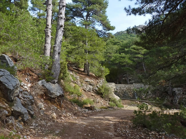
This stage begins, leaving the main track on which we have arrived here and descending by another much narrower forest track heading south. At 100 meters we find a barrier that limits access to motor vehicles, we cross it and head towards a fairly deep ravine that crosses perpendicularly. The soil on this slope is quite poor, with rock outcrops that largely condition tree colonization. Here the black pine has no competitor, twisting its roots between the rocks to cling to life.
Béjar River
We cross this high mountain river, seeing on the left one of the many dams built in these mountains to stop the erosive action of the water. We will find notable differences in the vegetation between different slopes, even at the same altitude, which is due to the different microclimates that are generated depending on the type of soil and the orientation, which determines the light they receive and the temperatures.
Botanical interest area
In one of the curves through which this forest track descends, we find a unique corner that will attract our attention because it is different from what we have seen so far. There is a fence that surrounds an area of ??special protection, to the right of the track. Both inside and outside of it there are specimens of species more typical of the north of Spain than of the south, which contrast with the vegetation that surrounds us and form a small botanical island, isolated because similar conditions are not found for several kilometers around. In addition to maples, oaks, boxwoods and honeysuckle, we will see several examples of yew, the oldest tree in Europe, made of very resistant wood, which in past times was highly appreciated in the manufacture of arches and in shipbuilding, and which curiously had a More than important role in Roman times, as its deadly toxin was used as a poison, since all parts of the tree were poisonous except for the reddish pulp of the aril that surrounds the seed.
Arroyo de la Cueva de Jaén
After enjoying some exceptional views over the town of Quesada, Sierra Mágina, the Barranco de Béjar and Collado Zamora itself, the starting point, we leave a small rounded promontory on the left with no tree vegetation, 3.6 km from the beginning . Below us, a ravine announces the proximity of the Arroyo de la Cueva de Jaén. This place is ideal to observe a colony of griffon vulture, which on the other side of the ravine finds in the strata of a sedimentary fold the ideal holes and ledges for resting and nesting. In addition to hawks and other raptors that inhabit the entire park, in this area we can hopefully contemplate the agile and majestic flight of the largest of our raptors, the golden eagle. For bird watching it is convenient to go as unnoticed as possible, so it is not convenient to leave the track. They are protected birds and the vertical walls are of great importance because they are their nesting points.
Continuing our track we will leave two lanes to the right before reaching the Arroyo de l ...
Arroyo de la Cueva de Jaén
After enjoying some exceptional views over the town of Quesada, Sierra Mágina, the Barranco de Béjar and Collado Zamora itself, the starting point, we leave a small rounded promontory on the left with no tree vegetation, 3.6 km from the beginning . Below us, a ravine announces the proximity of the Arroyo de la Cueva de Jaén. This place is ideal to observe a colony of griffon vulture, which on the other side of the ravine finds in the strata of a sedimentary fold the ideal holes and ledges for resting and nesting. In addition to hawks and other raptors that inhabit the entire park, in this area we can hopefully contemplate the agile and majestic flight of the largest of our raptors, the golden eagle. For bird watching it is convenient to go as unnoticed as possible, so it is not convenient to leave the track. They are protected birds and the vertical walls are of great importance because they are their nesting points.
Continuing our track we will leave two lanes to the right before reaching the Arroyo de la Cueva de Jaén. To the left, the vertical walls are impressive, behind which is located the Aguilón del Loco, at an altitude of 1856 meters, whose meltwater nourishes this stream. On the other side of this stream the track runs under the vultures that we have seen previously. After a good stretch of relaxed walking we arrive, 6.7 kilometers from the beginning, at Collado de la Hoya de los Corzos, where we will discard another forest track that starts to the right. From here our path zigzags downward somewhat more pronounced.
Extremera River
The vegetation has changed drastically, appearing the Aleppo pines mixed with holm oaks, kermes oak, junipers, and boxwood. We arrive at the Extremera river, whose crystalline waters descend from the Barranco de los Arenales and the Barranco Extremera, both located under the Picón del Guante, another of the peaks of this area, to later cross the Cerrada Extremera, located to the left of the track where we are. We will have to ford the river and discard another track in poor condition that comes out to the right after 100 meters. From here we will walk parallel to the limestone cliff on the left, while to the right the olive groves mark the limit of the protected area.
9.6 kilometers from the beginning, in a small clearing of the forest, we leave the ruins of the El Garbanzal forest house on the left, of which there is hardly a small wall. A few meters away we find a fork in the tracks and we must continue to the left, to make one of the most spectacular sections of the Bosques del Sur trail, the Pasada de Bosques, crossing the Picones de Fique. It is hard to believe that vehicles can pass this road, as it is impressive even when walking. After progressively approaching the vertical limestone wall that we keep to the left, the path gains height to cross through a gate between the stones.
Barrier
When leaving the gate we find another barrier that limits vehicle access. We are on the hill of Los Picones and to the left El Rayal, 1834 meters high, catches our attention. A few olive and almond trees in front of us indicate that we have reached more humanized landscapes. We come to a track that is wider than the one we have taken up to now, at which junction we must continue to the right downhill until kilometer 12.3 of our route, where we will reach the A-6206 road. This will accompany us to the right for 500 meters, now in a gentle climb.
Port of Tíscar
We crown the Puerto de Tíscar at an altitude of 1183 meters. In addition to quenching our thirst at the fountain that exists there, the Torreón del Infante Enrique is a must, with its striking exterior metal spiral staircase. From here, large expanses of both the countryside and the mountains are dominated, dominated by peaks such as El Rayal and El Caballo.
Our route continues along an olive track, which alternates in sections with a bridle path heading southwest. We walk downhill and in the direction of another watchtower, located on the rocky crest of the Peñas Negras, standing out in the valley. On this route we will cross the A-6206 road twice, until we reach the Vadillo fountain, located next to a bar-restaurant. There we cross the Arroyo Vadillo and join the aforementioned road 15.3 km from the beginning.
Tíscar
We travel about 300 meters along the road to deviate, to the left, through the entrance to Tíscar, which means passage between mountains in the Berber language. A curious tunnel under a building gives access to the small square where the Tíscar sanctuary is located, where we will also find several fountains. In the sanctuary, the access doors to the church through the atrium, the sacristy and small terracotta images of the Virgin and the Evangelists stand out. And just above, above the village, is the watchtower, difficult and dangerous to access.
After visiting Tíscar, we will exit through the other existing entrance, and we rejoin the road to the left, just where a small viewpoint is located on the fence that the Tíscar River has formed below us.
We walk along the asphalt road for 200 meters to deviate later to the right, following a sign that indicates «Natural Monument Cueva del Agua». We leave the asphalt access track to the cave just 100 meters away, to continue along the dirt track to the left. A small circula ...
Tíscar
We travel about 300 meters along the road to deviate, to the left, through the entrance to Tíscar, which means passage between mountains in the Berber language. A curious tunnel under a building gives access to the small square where the Tíscar sanctuary is located, where we will also find several fountains. In the sanctuary, the access doors to the church through the atrium, the sacristy and small terracotta images of the Virgin and the Evangelists stand out. And just above, above the village, is the watchtower, difficult and dangerous to access.
After visiting Tíscar, we will exit through the other existing entrance, and we rejoin the road to the left, just where a small viewpoint is located on the fence that the Tíscar River has formed below us.
We walk along the asphalt road for 200 meters to deviate later to the right, following a sign that indicates «Natural Monument Cueva del Agua». We leave the asphalt access track to the cave just 100 meters away, to continue along the dirt track to the left. A small circular era below us shows us the way to go.
At this point we must make a mandatory stop and make a small detour to visit the impressive Cueva del Agua. You have to continue the asphalt track for 100 more meters, and then a small pedestrian tunnel 10 meters long and one meter high gives access to the grotto. In it, capricious stone forms are observed, between waterfalls and pools of water, with a characteristic and exuberant rock vegetation. Legend has it that, during the Muslim era, Christians had great interest in recovering this place because it was the scene of an apparition of the Virgin. For this reason, the Moors threw their image from the tower into the closed river, but the image would appear again and again. Tired of it, its boss, Mahomad Andon, tore it to pieces, but when the Christians conquered the castle mysteriously the Virgin reappeared.
Mr. Pedro
We access this village from its upper part. It is very small and somewhat scattered, around a single descending cemented main street. It receives its name in honor of the infant Don Pedro, uncle of Alfonso XI, who in 1319 conquered the Hispano-Muslim fortress of Tíscar. With less than a hundred inhabitants and surrounded by mountain olive groves, its neighbors seem to have stopped time and maintain a strong attachment to their customs and traditions. Along a cement track we descend between olive groves, leaving on the right the so-called Blue Pilon, a place of magical beings and legend, which is located right where the ravine opens, where a charming waterfall precipitates the waters of the Tiscar river over a pool, originating a pleasant freshness and a unique bathing area during the summer.
Belerda
Later, the cement track runs very close to the Tíscar river and parallel to it. We pass an entrance to La Mendoreja to the right, a small farmhouse halfway between Don Pedro and our end of the stage, which is Belerda. It is nestled under the shelter of large rocky walls and is one of the most picturesque and welcoming villages in the entire area. It is also the starting point of the next stage of the Bosques del Sur trail, which starts to the left, just 100 meters from the end of it.
Both in the Tíscar area, as in Don Pedro and Belerda, there are tourist accommodation, mainly rural houses, and it is advisable to arrange the reservation in advance.
Additional information
The mountain goat
The current abundance and the extraordinary adaptation to the environment of the mountain goat (Capra pyrenaica) give this species an unbeatable animal halo, resistant to everything. Actually, it is resistant to almost everything. Endure the cold, the snow, the wind, the ice, the heat, the rocky soils, the shortage of food in winter. But it is fragile to a wrong management of its environment by man. We had the proof at the end of the 80s of the 20th century, when the park was on the verge of completely losing the species that has so often been described as queen of the peaks.
Indeed, at that time an epidemic of scabies was unleashed, caused by the Sarcoptes scabiei mite, which in just over a year wiped out 90% of the ibex. Their populations were reduced from about 10,000-12,000 individuals in 1986, to about 250-300 to what they remained in 1991.
Several were the causes that originated this drastic decline. Among them stands out the overpopulation of deer, fallow deer and mouflon, having been the last two s ...
The mountain goat
The current abundance and the extraordinary adaptation to the environment of the mountain goat (Capra pyrenaica) give this species an unbeatable animal halo, resistant to everything. Actually, it is resistant to almost everything. Endure the cold, the snow, the wind, the ice, the heat, the rocky soils, the shortage of food in winter. But it is fragile to a wrong management of its environment by man. We had the proof at the end of the 80s of the 20th century, when the park was on the verge of completely losing the species that has so often been described as queen of the peaks.
Indeed, at that time an epidemic of scabies was unleashed, caused by the Sarcoptes scabiei mite, which in just over a year wiped out 90% of the ibex. Their populations were reduced from about 10,000-12,000 individuals in 1986, to about 250-300 to what they remained in 1991.
Several were the causes that originated this drastic decline. Among them stands out the overpopulation of deer, fallow deer and mouflon, having been the last two species artificially introduced to promote large game hunting, and whose populations grew disproportionately in the absence of their natural predator, the wolf, which, somehow, cornered the goat in the fight for space, depriving it of food resources that weakened it, making it more susceptible to disease.
This situation was warned in various scientific studies in 1978 and 1985, beginning to see the first bodies in 1987, without the Administration taking measures. Only in 1989, when scabies was already a problem that affected most of the mountain goat population, the Administration began to take control measures, reducing by selective hunting the populations of fallow deer, mouflon and deer, whose overpopulation, for on the other hand, it had been shown to be detrimental to some species of flora protected by their scarcity.
The other direct cause of this scabies epidemic was due to domestic livestock and, above all, to the animal health conditions of said herd, as some researchers pointed out that it was these cattle that transmitted the disease to the ibex. Fortunately, today the park's cattle cabin is in perfect sanitary condition.
The mountain goat was saved from extinction, but the regulation of the populations of large mammals is still necessary to restore the ecological balance that was broken with the introduction and artificial promotion of some of them.

Follow us #JaénParaísoInterior


