


Refugio Casa Forestal La Parra - Refugio Majalserbal

The landscape of the area that we cross in this stage is characterized by very tight scale-like formations, with limestones and dolomites that originate very abrupt and steep reliefs, for that reason we are not wrong when considering this section as one of the most spectacular by its cuts of vertical walls, cliffs and boats, which mark our transit at all times.
We start the tour at the La Parra forest house, where a basic overnight shelter has been set up for users of this trail. In addition to the breathtaking landscape that we find in the area of ??Cueva del Peinero and Cerrada de San Ginés, we partly cross the Aguascebas Grande and Aguascebas de Gil Cobo, two spectacular streams that make their way through narrow passages between rocks, originating numerous waterfalls of water and where we can enjoy two magnificent recreational areas.
The botanical diversity is remarkable, with mixed pine forests and a series of species that are more abundant here than in the rest of the natural park, such as black juniper and box, also finding a large number of junipers and some centenary yews ...
The landscape of the area that we cross in this stage is characterized by very tight scale-like formations, with limestones and dolomites that originate very abrupt and steep reliefs, for that reason we are not wrong when considering this section as one of the most spectacular by its cuts of vertical walls, cliffs and boats, which mark our transit at all times.
We start the tour at the La Parra forest house, where a basic overnight shelter has been set up for users of this trail. In addition to the breathtaking landscape that we find in the area of ??Cueva del Peinero and Cerrada de San Ginés, we partly cross the Aguascebas Grande and Aguascebas de Gil Cobo, two spectacular streams that make their way through narrow passages between rocks, originating numerous waterfalls of water and where we can enjoy two magnificent recreational areas.
The botanical diversity is remarkable, with mixed pine forests and a series of species that are more abundant here than in the rest of the natural park, such as black juniper and box, also finding a large number of junipers and some centenary yews. And as a strong point, the place of the Cerrada de San Ginés where there are several botanical endemic species.
In the final part of the route, we ascend to 1,440 meters above sea level on the Lancha de la Escalera, in a more rugged and treeless terrain, where the horizon in front of the Collado del Perenoso, Pedro Miguel and Agrión, among others, widens. We can spend the night in the Majalserbal tinada, a lost place with unforgettable views where a space has been set up as a refuge for hikers.
Rugged terrain, rich in fauna linked to the aquatic environment and rocky areas, such as amphibians, fish, small birds and mammals, as well as abundant deer and wild boar in the densely wooded areas.
Technical information
Route Name Rutas Bosques GR247
Rutas Bosques GR247 8: Refugio Casa Forestal La Parra - Refugio MajalserbalHUSO 30S
Refugio casa forestal La Parra: x509495 y4218432
Refugio Majalserbal: x509198 y4214007
Refugio Casa Forestal La Parra: x509384 y4218225
Refugio Majalserbal: x509087 y4213800
TOTAL DISTANCE (IN KILOMETERS)12000
Asphalt or cement section 71 %
Section of track or forest road or promenade 24%
Senda section 5 %
tramos-de-Vía-pecuaria 0 %
ESTIMATED RUN TIMEO
3 h 48 minMAXIMUM SLOPE460 m
DIFFICULTY. ASSESSMENT ACCORDING TO METHOD MEASURE
2
MEDIO.
Severity of the natural environment
2
Itinerary
Orientation in the itinerary
2
Displacement
Difficulty moving
3
EFFORT.
Amount of effort required
TOTAL DISTANCE (IN KILOMETERS) 19540 M
Start
The Casa Forestal La Parra Refuge is accessed from Mogón by the Las Villas JH-7155 road. From Villanueva del Arzobispo it is accessed by the A-6202 road, and then by the aforementioned Las Villas road from the Puente de Los Agustines.
Final
From Mogón (Villacarrillo): we leave by the Las Villas JH-7155 road, we take the track to the right at the Aguascebas de Gil Cobo river and we deviate again to the right along the track indicated as "Carril a Peña Corva", to Majalserbal. From Villanueva del Arzobispo: we leave by the A-6202 road, we continue along the Las Villas JH-7155 road, then to our left along a track in the Aguascebas de Gil Cobo river and we turn right along the track indicated "Carril a Peña Corva ”, to Majalserbal.
INTERMEDIATE POINTS
PLACE
POSITION
TYPE OF ROAD
Km 9,2
Highway
CYCLABILITY
The first kilometer of the Stage is on a poorly defined path and very uneven terrain.
WATER POINTS
La Parra Forest House Refuge, Peinero Cave, Gil Cobo Recreational Area, beginning of the San Ginés Cerrada, Colorá Fountain, Majalserbal Refuge.
PREFRESHING POINTS
La Parra Forest House Refuge, Peinero Cave, Gil Cobo Recreational Area, beginning of the San Ginés Cerrada, Colorá Fountain, Majalserbal Refuge.
Rutómetro
La Parra Forest House Refuge
From the La Parra forest house, the first section of the route is through open field, on old farmland, for just 600 meters, until reaching a ruin on the right that corresponds to the Casa del Sotillo de la Parra. In this initial section, at dawn and dusk, it is common to observe some of the large mammals of the natural park, such as deer, wild boar and even mountain goats, which at night find an ideal place for provisioning.
Las Villas road
We join a narrow, paved road that crosses the Sierra de Las Villas, where we must go to the right. It is very little traveled, so we can walk placidly. At 700 meters we find a dirt track to the right that would take us, if we deviate from our stage (2.6 kilometers round trip), to the Molino de la Parra, located next to the Arroyo del Aguascebas Grande. Its state is dilapidated, but it shows the harshness of this land and of the people who until not so long ago inhabited the place.
Our journey continues along the aforementioned Las Villas road, and soon, 2.7 kilometers from the start of the stage, the side rocky walls mark the only possible step, already next to the Aguascebas Grande, which unravels in several jumps of Water. It is one of the many closed gates in the park, which is what the narrow and deep valleys enclosed between rock walls are called here. On the left we find several cavities that show the erosive action of the water in these limestone mountains, with forms of singular beauty.
Cueva del Peinero Recreational Area
This area is located to the right of the road and is an ideal area for rest, equipped with the characteristic equipment of a fountain and tables with benches. It is a very shady place through which the Aguascebas Grande flows placidly, whose crystal clear waters invite us to refresh ourselves if the day is good. To the left there is a dirt track that would take us to the old refuge of Cueva del Peinero, which was intended as a hunter's lodge and is now a rural house.
Continuing along the cross road, a few meters away you turn 180º crossing over the stream. Right on the same bridge, to the left, there is a path to go up to the source of the Aguascebas Grande. It is a path with some difficulty, winding and steep, which forces us on several occasions to cross this stream, jumping it in both directions, until we reach the source under the walls of Poyo de los Robles.
Panoramic view
The road twists and turns to gain altitude. In the first of the sharp curves to the left there is a beautiful panoramic view of the Cueva del Peinero house and the entire environment. In this area we find several specimens of yew, among an exceptional boxwood with junipers and junipers. The presence of griffon vultures is quite common, which have magnificent walls here, ideal for resting and nesting.
We soon surpassed 1300 meters of altitude, in a gentle ascent, leaving several boats on both sides, which are very characteristic rock formations, consisting of a large outcrop of flat and more or less smooth rock.
Gil Cobo Recreational Area
After a slight descent to 1260 meters of altitude, we reached another of the strong points of the route, the place of Gil Cobo with its recreational area. In addition to the characteristic facilities of this type of area, fountain and tables with benches, in summer there is a kiosk-bar and an exceptional bathing area, in a small dam of the Aguascebas de Gil Cobo stream.
Later, at 250 meters from the area, we must leave the road, just when crossing the bridge over the stream, to enter the dirt forest track, to the left. From this point the climb will be constant until the end of the stage.
Closed of San Ginés
A few meters after entering the track, parallel to Aguascebas de Gil Cobo, we pass the source of La Cerrada de San Ginés on the right. From this point, the lateral rocky walls narrow the valley through which we are advancing more and more, forming a singular enclosure whose width at some point becomes little more than that of the track we are walking on.
This closed is one of the most interesting corners from the botanical point of view of the entire natural park, since here we find several endemisms in its walls, such as the insectivorous plant known as Andalusian grasilla (Pinguicula vallisneriifolia), in addition to rare species such as some yew and exceptional bojedas.
Fork
When leaving the narrowing, we find a small esplanade with a fork. By the track on the left you reach the Collado del Perenoso, a strategic place to ascend the Pedro Miguel, 1830 meters high, which is the roof of this area. There is a panel that describes this interesting route, but it is a path that is not marked.
Our stage continues along the track to the right, along the Peña Corva lane, where in spring we will see the Cazorla violet (Viola cazorlensis) and soon we will enjoy an exceptional panoramic view of the Collado del Perenoso and Pedro Miguel as we gradually approach another of the boats in the area, the Lancha de la Escalera.
Colorá Fountain
The fountain is located on a pronounced curve in the track, and has a nice stone table that invites us to a stop, the landscape being dominated by black or salgareño pines and boxwood.
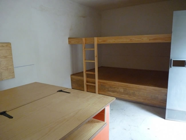
Tinada Majalserbal Refuge
To the left, on a small hill above La Lancha de La Escalera, a few meters from the track, we find the building of an old tinada used as a shed for cattle. On one of its sides, one of the mountain refuges has been set up for hiking use. At the front we will also find a water trough that will allow us to stock up on water.
Additional information
A carnivorous plant
The cliffs and rocks of these mountains, with their gray and copper colors that change in tone according to the light they receive, not only give character to the landscape of the natural park. They are also, despite their naked appearance, quite a world for vegetation. And it is that in them grows a huge variety of species that, despite their always humble appearance, are true champions of flora, due to the very difficult conditions in which they are capable of living. It is about the rupicolous flora.
The most striking of them, and perhaps the most curious of the natural park, is the grease or flytrap (Pinguicula vallisneriifolia), which is present at this stage, specifically in the Cerrada de San Ginés. It is an insectivorous plant, in whose slimy leaves small insects are attached whose nutrients are absorbed by the plant externally.
It is endemic to the natural park, where some 70 nuclei are known. Being on the rocks it is less vulnerable to herbivory than other endemic plants, sometimes threatened by the action of domestic livestock. However, the degradation of its habitats, collection and the progressive aridity of the climate are the most serious problems faced by this species, since it needs walls that permanently ooze water. It is classified in the category of «Vulnerable» in the Red Book of the Endangered Wild Flora of Andalusia.

Follow us #JaénParaísoInterior


