


Hinojares - Quesada (Route of the Nasrids)
Routes
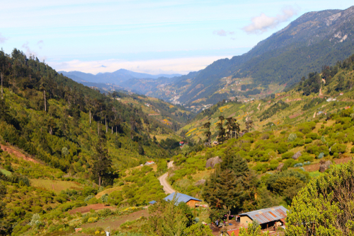
Although the route passes through natural areas of extraordinary beauty, the main attractions on this route are historical and cultural. You will cross an area that was once a frontier land between Moors and Christians, remaining as such for three centuries until Granada was definitively conquered in 1492. The route is essential for a proper understanding of the culture and uniqueness of the lands that made up the former Settlement of Cazorla. The Settlement was created in 1231 and depended on the Archbishopric of Toledo until it was abolished in 1811 by the Spanish Cortes or Parliament in Cadiz.
Program
RUTÓMETRO:
Km 0.0. Departure. In the Plaza de la Constitution in Hinojares (x=500190; y=4174475), at the Fuente de las Ranas, set your mileometer to 0.0 and leave the town going up the street where the church is located, in the direction of the Tíscar road (A-6206).
Km 1.5. Tranco de la Zorra junction (x=501180; y=4175910). At the stop sign, set your mileometer to 0.0 and turn left.
Km 1,1. Cruce de Cuenca (x=501825, y=4175910). Dejamos la carretera principal, para desviarnos a la derecha.
Km 3.7. Cuenca (x=502725; y=4176830). Park at the Medical Centre to visit the source of the Siete Fuentes (Seven Springs) and the village; reaching the ruins of the fortress and the medieval village of Castellones de Cuenca is not easy, but when you return along the main road and pass the last houses in the village, you will see this area on the other side of the ravine. When you reach the A-6206, set your mileometer to 0.0 at the stop sign and turn right.
Km 10.2. Belerda junction (x=498490; y=4180130). Continue straight on towards Quesada. Another option is to turn left and visit Las Casillas de Don Pedro and Las Belerdas and then return to this point and continue left, the next point is at Km 0.3.
Km 10.5. Entrance to Cueva del Agua (Water Cave) (x=498220; y=4180260). Turn left, after 300 m you will come to the parking area and the entrance to a large open area traversed by a stream, the Arroyo de Tíscar, which has been proposed as a Natural Monument. When you leave the main road, turn left to visit the Sanctuary and Peña Negra Castle. Return to the A-6206, heading towards Quesada, and at the entrance to the Vadillo picnic area (x=498015; y=4180895) set your mileometer to 0.0.
Km 4,8. Puerto de Tíscar (x=496675; y=4182345). Park your car in the space on the right side of the road and walk up to the Atalaya del Infante Don Enrique viewpoint (13th century). Picón del Rayal peak (1 834m), shaped like a colossal wave, stands behind the tower. The word rayal was synonymous to 'border' in the days of the Christian reconquest.
Km 13,5. Quesada (x=494160; y=4188735). Here you can visit the Arco de los Santos, the Arco de la Maquita de Utrera, the remains of the Moorish Fortress, two churches and the Rafael Zabaleta Museum.
Follow us #JaénParaísoInterior


